The Night Sky over West Virginia
A stargazing companion for the state that does not expire: the meteor calendar, the darkest places, and how to read any year's sky.
- The annual meteor calendar with moon interference figured in
- The darkest places in the state, and how to get to them
- How to pick the right night in any year
- Beginner star-hop targets by season
- Evergreen: it does not expire at the end of a year
$9.99one-time
Instant download · yours to keep, with no account and no renewal · full refund within 30 days
A look inside
What the West Virginia pages actually look like
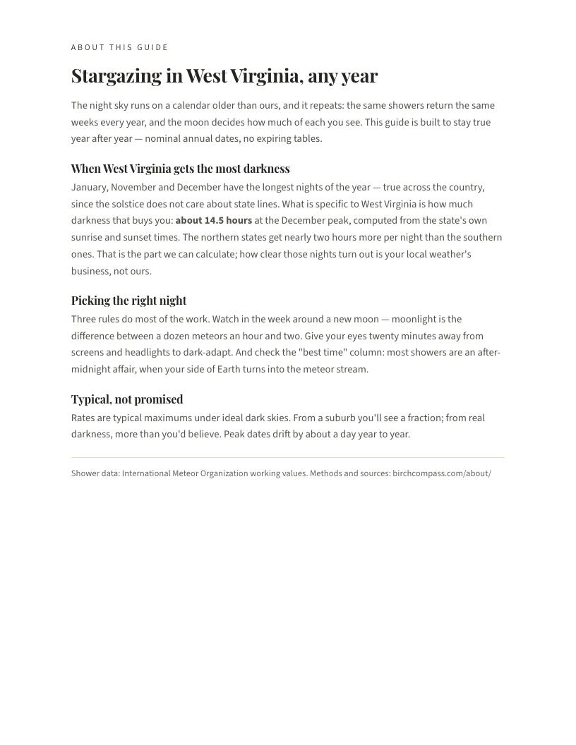
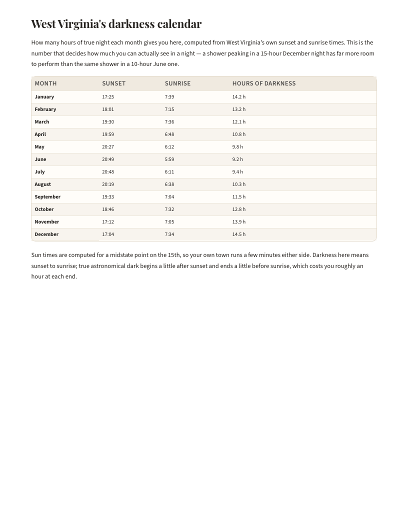
From the West Virginia edition
Some of what is actually in it
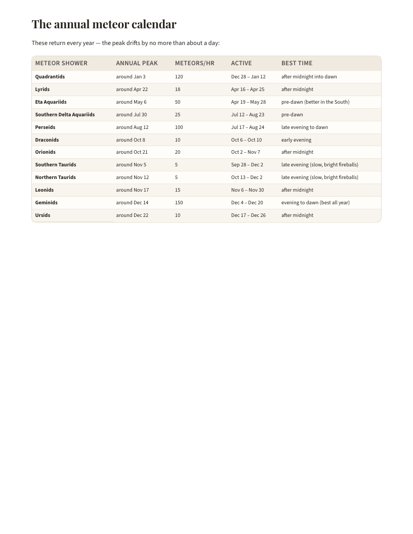
Every dark-sky place the West Virginia edition sends you to, and every meteor shower it tracks through the year:
- Spruce Knob (Monongahela National Forest)
- Dolly Sods Wilderness
- Green Bank area, Pocahontas County (National Radio Quiet Zone)
- Watoga State Park
- Quadrantids
- Lyrids
- Eta Aquariids
- Southern Delta Aquariids
- Perseids
- Draconids
- Orionids
- Southern Taurids
- Northern Taurids
- Leonids
- Geminids
- Ursids
How the West Virginia year breaks down
Counted, not claimed
On the 2027 numbers the standout for West Virginia is the Quadrantids: about 120 an hour at its peak with the moon only 18% lit, best after midnight into dawn.
The Geminids, by contrast, peak against a 100%-lit moon that year: the kind of night the guide tells you to skip rather than let you find out at 2am.
The calendar runs every major shower of the year (12 of them), with the moon's brightness worked out for each peak, so West Virginia knows which nights are worth the drive.
In the box
Exactly what you receive
| West Virginia pages | 8 pages: the meteor calendar, dark-sky places and seasonal targets |
|---|---|
| Format | PDF, laid out for both Letter and A4 |
| Delivery | An instant download link, plus a link you can re-open for 72 hours |
| Access | Yours to keep: no expiry, no account, no subscription |
| Refunds | Full refund within 30 days, no questions |
How it works
From checkout to the field
Buy it
Checkout takes a card and an email address: no account to create.
Open it straight away
The download link appears immediately and the West Virginia files are yours to keep.
Use it through the year
Print the West Virginia pages you want and take them outside; they are laid out with room to write on as the season moves.
Free and paid, side by side
The West Virginia pages here stay free. Here is what the edition adds.
| The free West Virginia pages | The Night Sky over West Virginia | |
|---|---|---|
| What it covers | The month West Virginia is in, free and always | All twelve West Virginia months, planned before they arrive |
| Dark places | West Virginia's 4 dark-sky spots, described | The same spots with the year's meteor calendar around them |
| Where you can read it | On a screen, wherever West Virginia has signal | On paper, in the field, with no signal at all |
| Price | Free, and staying that way | $9.99 once: no renewal, no account |
Before you buy
Who this is for
Made for
- People who want to know which West Virginia nights are worth the drive
- Beginners with no telescope and no jargon
- Anyone planning a trip around a meteor shower
Not for
- Deep-sky astrophotographers; this is naked-eye and binocular observing
Everything here describes typical timing across West Virginia, drawn from long-run records: weather, elevation and how close you are to water all move the real dates around. So the West Virginia pages say "usually early May" and never "May 4th", which is not hedging but the most the data can honestly carry.
Where it comes from
Compiled from
International Meteor Organization. How each of these is used in the West Virginia edition, and which figures are measured rather than modeled, is set out in the methodology.
Questions
Before you decide
Is this specific to West Virginia, or a national guide with the name swapped in?
It is built from West Virginia's own data. Peak times and moon brightness are computed for West Virginia's latitude, and the dark-sky places are West Virginia's own: 4 of them.
How accurate is the timing for West Virginia?
It describes typical timing across West Virginia drawn from long-run records, and because weather, elevation and habitat move real West Virginia dates around it says "usually early May" rather than "May 4th".
Is it worth paying when the West Virginia pages here are free?
The free West Virginia pages are the month you are in; this is the whole West Virginia year, planned before it arrives and printable, so you are not holding a screen in the garden.
Will it work for my part of West Virginia, or just the big cities?
It is written at state resolution: West Virginia as a whole, with regional notes where West Virginia genuinely differs end to end, and nothing behind it is recorded finely enough to honestly promise more than that.
What format is the West Virginia edition, and can I print it?
A PDF laid out for both Letter and A4, one page per sheet: printing it is the point, since the West Virginia pages are made to be carried outside.
What if the West Virginia guide is not what I expected?
Email hello@birchcompass.com within 30 days for a full refund on the West Virginia edition, and keep the files either way: asking for them back would be theatre.
Prefer to read online first? The free West Virginia night sky reference covers the same ground on screen.
The rest of the West Virginia shelf
Also for West Virginia
West Virginia Nature Year 2027
Everything Birch Compass knows about a year of nature in one state: the book, the posters, the sky calendar, the…
$34.00
The West Virginia Set
Three printable West Virginia editions in one purchase: the twelve-month journal, the native plants reference and…
$29.00
West Virginia Nature Year 2027 + Journal
The complete West Virginia Nature Year with the undated journal beside it: everything the site knows about the year…
$42.00
The West Virginia Nature Journal
Twelve printable month pages: a reference side built from public nature data for your state, and a field-notes side…
$14.00
Birds of West Virginia
The state's most-recorded birds, ranked from survey data, with when each is present through the year and a life list…
Not on sale yet